
Gabon – Gambia (Republic of The) – Georgia – Germany – Ghana – Greece – Grenada – Guatemala – Guinea (<Conakry>) – Guinea Bissau – Guyana (<Georgetown>) – Colman’s Source Library


Gabon Volcano List
Zero (0) Active Volcanoes. Sol_Ert_0300z_12_NOV_02023AD
Gambia (Republic of The)

GMB
Gambia Volcanoes
- USA – Smithsonian Institute – Global Volcanism Project Not listed.
Gambia Volcano List
Zero (0) Active Volcanoes. Sol_Ert_0300z_12_NOV_02023AD
Georgia
GEO
Georgia Volcanoes
- USA – Smithsonian Institute – National Museum of Natural History Global Volcanism Project – Georgia
Georgia Volcano List
Zero (0) Active Volcanoes. Sol_Ert_0300z_12_NOV_02023AD


Germany Volcano List
Zero (0) Active Volcanoes. Sol_Ert_0300z_12_NOV_02023AD

Ghana Volcano List
Zero (0) Active Volcanoes. Sol_Ert_0300z_12_NOV_02023AD
Greece


GRC
Greece Volcanoes
- USA – Smithsonian Institute – National Museum of Natural History Global Volcanism Project – Greece
Grenada

GRD
Grenada Volcanoes
- USA – Smithsonian Institute – National Museum of Natural History Global Volcanism Project – Grenada
Grenada Volcano List
| Kick ’em Jenny | North of Grenada | 2017 CE | Complex |
Guatemala
GTM
Guatemala Natural Disasters
Wikipedia – GTM – Natural Disasters
Guatemala Earthquakes


Wikipedia – Guatemala’s highlands lie along the Motagua Fault, part of the boundary between the Caribbean and North American tectonic plates. This fault has been responsible for several major earthquakes in historic times, including a 7.5 magnitude tremor on 4 February 1976 which killed more than 25,000 people.
Guatemala Flood List
Guatemala Volcanoes
- GTM – INSIVUMEH – GeoPhysics Menu – VOLCANOLOGY
- Bulletins Daily – Weekly – Monthly
- Volcanic Hazard Maps
- GOES Volcanic Monitoring
- Wikipedia – List of Volcanoes in Guatemala
- USA – Smithsonian Institute – National Museum of Natural History Global Volcanism Project – Guatemala
- https://www.terra-guatemala.com/volcanoes
Guatemala Earthquakes
- Wikipedia – Motagua Fault Zone
Ert_GTM_T01976_02_04 Earthquake M_7.5 Los Amates, Guatemala city
Dead >= 22,700, Injured >=76,000
Wikipedia GTM – Los Amates, M7.5 Earthquake
GBR – International Seismological Centre ISC event 717474
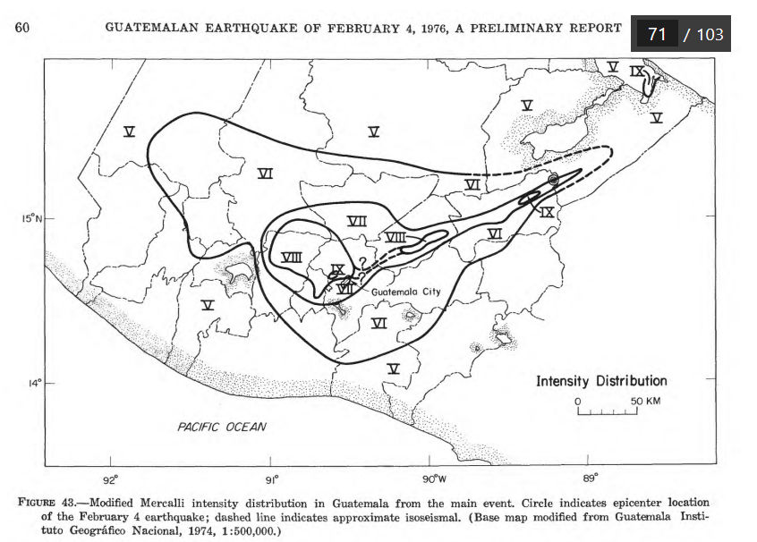
UNITED STATES DEPARTMENT OF THE INTERIOR – GEOLOGICAL SURVEY – THE GUATEMALAN EARTHQUAKE OF FEBRUARY 4, 1976, A PRELIMINARY REPORT A. F. ESPINOSA, EDITOR
- The Guatemalan earthquake of February 4, 1976, with a surface-wave magnitude of 7.5, was generated by left-lateral slippage on the Motagua fault and was felt over an area of at least 100,000 km2. This earthquake claimed more than 22,700 lives and injured more than 76,000 people.
Guatemala Flood List
United Nations – Relief Web
Guatemala: Floods – Jul 2023
Guatemala Volcano List
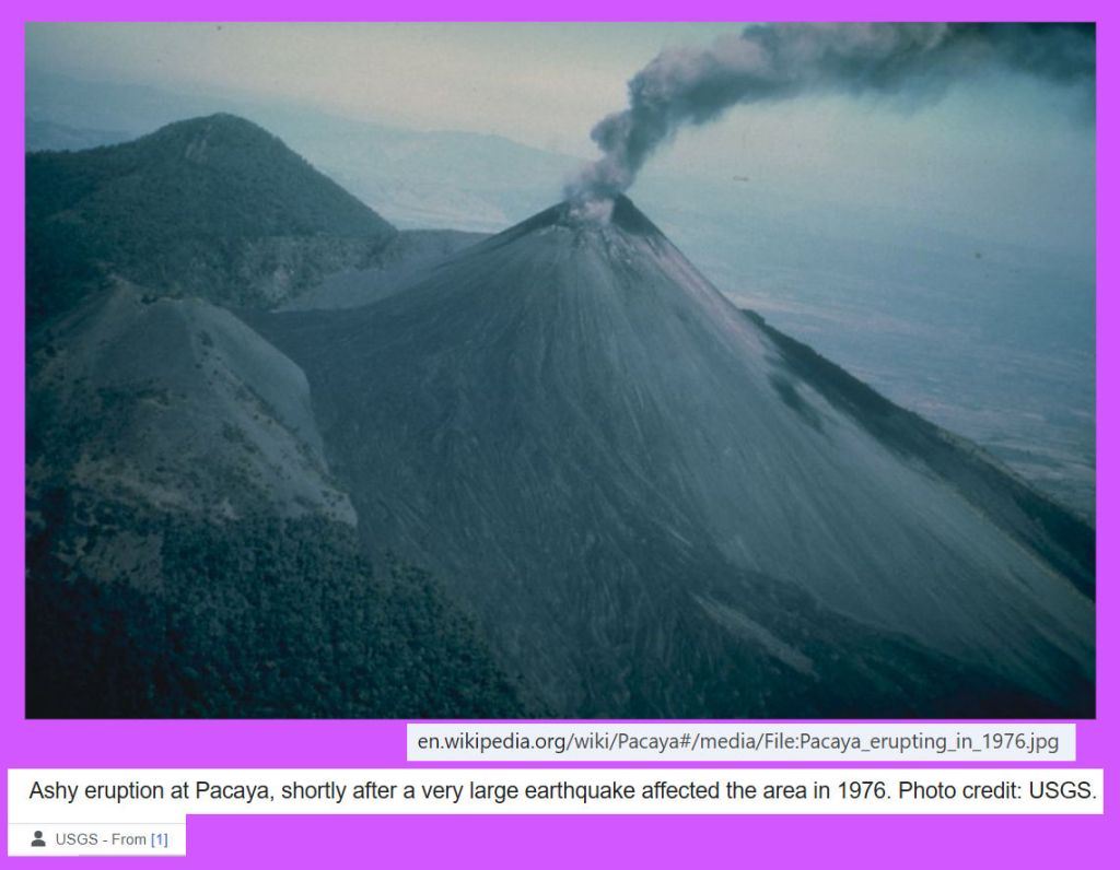
GTM – Santa Maria and Santiaguito – Gagxanul (K’ iche) (current)
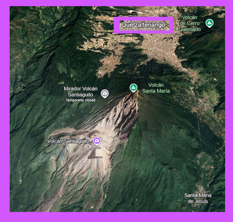


- Wikipedia – Santa Maria Oct 1902 The eruption had a VEI SIX (6) ‘Colossal’ >10km^3
GTM – Volcán de Fuego (current)
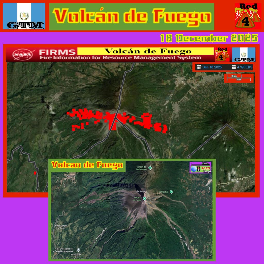


- Wikipedia – Volcán de Fuego
- Copernicus T02024_11_04 Volcán de Fuego (Guatemala) monitoring with the Normalized Hotspot Indices (NHI) tool
GTM – Volcán de Agua – Hunahpú (Kaqchikel) Junajpú (Maya) “Volcano of Water”
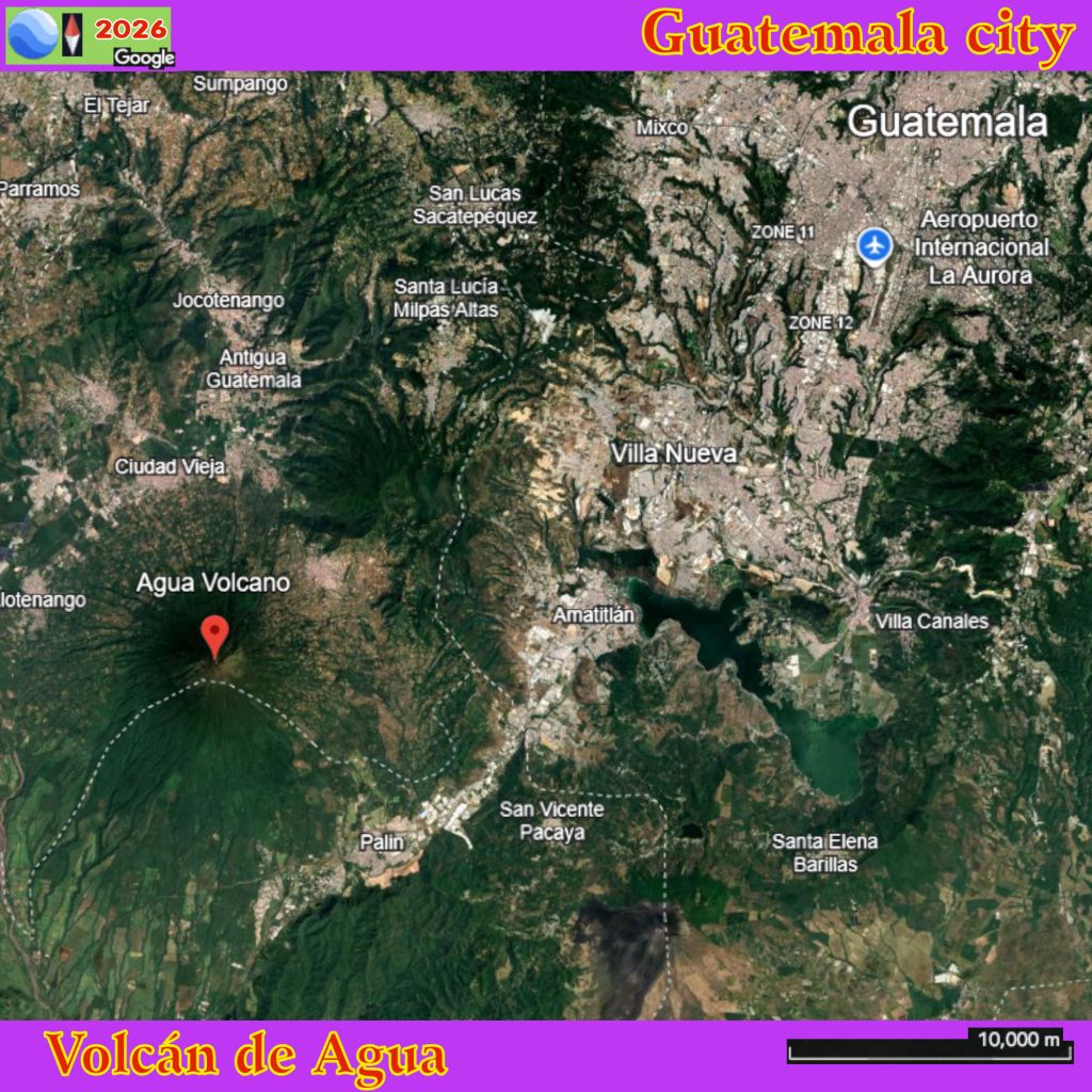

- Wikipedia – Volcán de Agua – The Spanish conquistadors also called it Hunapú until a lahar from the volcano on September 10, 1541, destroyed the original capital of Guatemala (now known as Ciudad Vieja), after which the capital was moved to Antigua Guatemala. Among the casualties was the governor Beatriz de la Cueva.
- Vogripa_org – Volcán de Agua
GTM – Volcán Tajumulco
- Wikipedia – Volcán Tajumulco, at 4,220 metres (13,850 feet), is the highest point in the Central American countries.


Guinea Volcano List
Zero (0) Active Volcanoes. Sol_Ert_0300z_12_NOV_02023AD
Guinea Bissau

GNB
Guinea Bissau Volcanoes
- USA – Smithsonian Institute – Global Volcanism Project Not listed.
Guinea Bissau Volcano List
Zero (0) Active Volcanoes. Sol_Ert_0300z_12_NOV_02023AD
Guyana Volcano List
Zero (0) Active Volcanoes. Sol_Ert_0300z_12_NOV_02023AD
